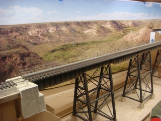
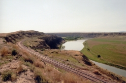
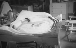
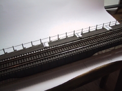
My layout finally has reached a stage where I could transition from construction and begin to think about scenery. The backdrop of a shelf style railroad is so important to completing the scene and I knew this was important to get right. My first strategy for a backdrop was the use of photography. I have a fair amount of experience creating panoramic images so when I had the opportunity to visit one of the scenes in my railroad, Virgelle, MT, I took lots of pictures. Upon getting home, however, I realized how difficult it is to make a panorama with such an extreme aspect ratio. My backdrops has an extremely wide aspect ratio with a size of 12 inches high by 15 feet wide. My photos did not produce a panoramic with sufficient length and ended in failure and I was back to the drawing board.
I have no artistic ability but that did not stop me from trying my hand a practicing painting. I did a lot or reading on technique including several MR articles about “how easy” it can be to paint a backdrop. I made several attempts at practicing painting but the results were terrible.
I was discussing my project with a colleague at work ( an experienced gamer) and he suggested I take a look at a terrain generation software package called Terragen. Terragen is an application that uses mathematical functions called fractals to generate realistic terrain scenes. Fractals are used to generate hills, valleys, rocks, surface shading (grass and dirt) and clouds. Other objects such as models of trees and plants can also be added to the scene. Terrain be generated by the application or actual elevation map data such as provided by the USGS can be imported providing the ability to produce a scene from actual locations…. like Virgelle, MT!
Terragen is similar to other terrain simulation packages like Bryce, 3DMax and others and are used to create scenes for games and movies. Terragen was used in scenes of the film The Golden Compass as well as other movies. The package costs much less than similar packages at about $300 but is available in a demo version that is fully functional only limiting the size of the image so you can try your hand before you buy.
The results from this application in the hands of the experts is simply amazing. Some great examples can be seen at www.terragen.org. The application, however, is not easy to learn. No manual has been written yet for this application but a lot of tutorials contributed by users and a very active user board that will get you through. I started my journey with Terragen in October of 2009 and it has taken me to August 2010 to bring my model to a point that I am satisfied. The time investment is significant but I am convinced that this technique is going to result in an image that rivals photographs and will be a key feature adding realism to my layout. The good news is the multiple images can be produced using the same terrain and texturing model with just a different camera position to provide a new scene.
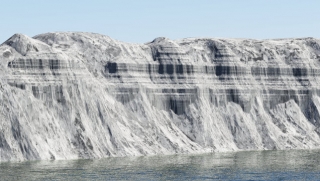
Terragen is truly a model of a world and starts with a bare planet and a sun. Modeling a specific locale I downloaded elevation data from the USGS of the Virgelle, MT area and included the mountain range that is approximately 50 miles to the east. The resolution of the USGS DEM data is limited by national security concerns. (We can get higher resolution for the rest of the world). The initial image with the unshaded terrain already provided a very interesting image that immediately created excitement that I was on to something. This bare image is just the terrain with a grey shading applied to show shadows and terrain details. Certain detail terrain features are not present in the data but fortunately Terragen can augment with fractal roughness, filling in the gaps. There are also special functions that can create feature such as strata.
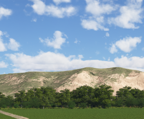
The Missouri river passes through my scene and her too, Terragen can model water, waves, reflectivity. Various types of clouds can be created as well and many samples from experienced Terragen modelers are available online free or for a nominal fee. While distant vegetation is created with fractals as well, close up plants and trees can be added from 3D models available again for free or at a nominal fee. The bulk of the effort is in the steps of shading the surface model with dirt, rocks and grasses to provide a realistic scene. The shaders are added to the scene and contain filters for terrain elements such as elevation and slop providing an ability to have some control over how the various shaders apply color and roughness (displacement). There is also the ability to paint regions to get specific control of shading in certain areas. I used this feature to place trees along the Missouri river and create wheat fields.
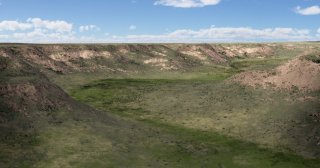
To obtain the wide aspect ration image I needed to make a panorma, just like my original backdrop idea. Int his case, however, the virtual camera can be rotated just within my model, rendering an image for each frame. I created my backdrop panorama from 13 images blended into a panoramic using another application called PTGui. The beauty with Terragen is that there are no trees or building in the foreground to mess up your scene like a real panoramic. I augmented my finished scene with Photoshop by adding details from photos such as telephone poles, grain bins and roads and was ready for printing. The final rendering process can be painful as it takes a lot of computing power to generate these images. The fastest computer you can get your hands on is recommended. I upgraded from my ~2GHz dual core laptop to an Intel i7 930 Quad core and is sped up the processing time 10x. Still, the Coal Banks Coulee image frames took 260 hours each to produce an image 18″ high at a resolution of 150 dots per inch.
Printing my image turned out to be more difficult than I thought. There are plenty of choices out there for large format printing services online and in major cities. Most folks I talked with were advocating vinyl substrates. Many of these do not have very long lifetime specs and I need this thing to make it 20+ years. Second, vinyl tends to come with self-adhesive backing and the prospect of getting a 15 foot long sticker on my backdrop straight did not seem feasible. I also needed a very matte finish as any reflection would take away from the scene. Color calibration was also an issue as most banner printers are oriented around graphic designs, not photorealistic images. I ended up solving both issues by finding a printer that specialized in Giclee printing. This is a general term that applies to fine art reproductions using digital printing. My printer suggested a substrate material call Mural-Pro that is actually vinyl wallpaper base. This not only provided a projected long life and totally matte surface, but it is applied just like wallpaper which was something I had experience with.
At this writing I am still rendering my final full resolution images but I have received proofs back of the final image of Virgelle and it am very pleased with the results. The Mural-Pro material produces slightly muted colors which I this will work well as a backdrop should look like it is in the distance. Stay tuned for photos of the final installation which should take place sometime in January.
Resource References
| Terragen 2 | The modeling software that makes it all possible. | http://www.planetside.co.uk/ |
| PTGui | Excellent panorama stitching software. | http://www.ptgui.com/ |
| NWDA | Trees, bushes, grass and cloud object for a nominal fee. | http://www.nwdanet.com/ |


